- Home Page /
- Electronics /
- Car & Vehicle Electronics /
- Marine Electronics /
- Marine GPS Chartplotters /
- MAPTECHChartKit The Bahamas to Crooked Island...
0 ratings


Item #:
94803003
MAPTECHChartKit The Bahamas to Crooked Island Passage Region 9 7th Edition
Item #:
94803003
AUD 307
Price Details
Excluding Shipping & Custom charges ( Shipping and custom charges will be calculated on checkout )
*All items will import from US
0 ratings
Write a review
In stock
QTY:
Only 4 items left in stock.
Order now and get it around Thursday, July 02
Secured transaction
Ubuy works hard to protect your security and privacy. Our advanced payment security system ensures confidentiality by encrypting your information during transmission using AES (Advanced Encryption Standards) and SSL (Secure Socket Layer) protocols. Your payment details are 100% secure as we do not share your payment details with third party sellers.
Our Top Logistics Partners
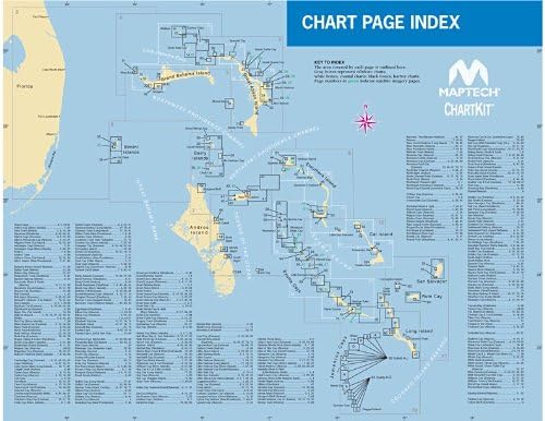
Comprehensive Chart Coverage for your Bahamas adventure with detailed navigation assistance.
Fast
Shipping
Free
Return*
Secure Packaging
100% Original Products
PCI DSS Compliance

ISO 27001 Certified
Note: Step Down Voltage Transformer required for using electronics products of US store (110-120). Recommended power converters Buy Now.


What Stands Out
Detailed Navigation
Provides comprehensive, up-to-date charts for the Bahamas to Crooked Island, ensuring sailors have precise navigational information for safe sailing and exploration.
User-Friendly Format
Designed with clarity in mind, these charts are easy to read and interpret, catering to both seasoned mariners and novices for a smooth sailing experience.
Durable Material
Crafted from high-quality, water-resistant materials, ChartKit ensures longevity and resilience against harsh ocean conditions, providing reliable support for all nautical adventures.
Product Details
- Comprehensive Chart Coverage
- Surveys from multiple Private and Government Sources
- Satellite Images from Digtal Globe
- Marinas, Amchorages, Local Knowledge
| Product Dimensions (L x W x H) | 22 x 22 x 0.3 inches (55.9 x 55.9 x 0.8 cm) |
| Item Weight | 3.25 pounds (1.47 kg) |
| Manufacturer | Richardsons' Maptech |
| Item model number | R09 07 |
| Batteries required | No |
Who Should Buy?

-
Maritime Navigators
Ideal for sailors and boaters requiring accurate navigation charts for the Bahamas region, ensuring safe passage.
-
Travel Planners
Useful for individuals planning trips to the Bahamas, providing vital marine information for recreational exploration.
-
Fishing Enthusiasts
Beneficial for anglers seeking detailed underwater geography and fishing hotspots in the Crooked Island Passage area.

-
Land Travelers
Not suitable for individuals traveling by land, as the charts are specifically designed for marine navigation only.
-
Inexperienced Users
Not ideal for beginners unfamiliar with nautical charts; may find it challenging without prior knowledge in navigation.
-
Digital Navigators
Users who prefer digital navigation tools may find printed charts less convenient or outdated compared to modern solutions.
Product Description
Have any Query? Chat with us
Customer Questions & Answers
-
Question:
What is included in ChartKit Nauru to Crooked Island Passage Region 9 7th Edition?
Answer: ChartKit Nauru to Crooked Island Passage Region 9 7th Edition includes detailed nautical charts, cruising guides, and critical navigation information for sailors and boaters. This edition features updated and precise mapping of the waters around Crooked Island, along with essential information about anchorages, hazards, and points of interest. For sailors planning a voyage in the Bahamian waters, this comprehensive chart kit serves as a valuable resource for safe navigation and exploration. -
Question:
Who is the target audience for ChartKit Nauru to Crooked Island Passage Region 9 7th Edition?
Answer: The primary audience for ChartKit Nauru to Crooked Island Passage Region 9 7th Edition includes recreational boaters, professional mariners, and sailing enthusiasts. Whether you are a weekend sailor looking to explore new waters or a seasoned navigator needing accurate navigation tools, this chart kit supports diverse marine activities. It's perfect for anyone planning to navigate the Bahamian cays and islands safely and confidently. -
Question:
How can ChartKit Nauru to Crooked Island Passage Region 9 7th Edition enhance my boating experience?
Answer: Using ChartKit Nauru to Crooked Island Passage Region 9 7th Edition improves your boating experience by providing you with essential navigational information that enhances safety and awareness. The precise charts allow you to identify potential hazards while also guiding you to the best anchorages. This added layer of information helps ensure a smooth journey, making it particularly beneficial when exploring unfamiliar waters or planning overnight stops. -
Question:
Are there any updates in the 7th edition of ChartKit Nauru to Crooked Island Passage compared to previous editions?
Answer: Yes, the 7th edition of ChartKit Nauru to Crooked Island Passage includes significant updates compared to previous editions. These updates feature improved cartographic accuracy, updated navigational aids, and revised information on anchorages and local facilities. Such revisions are crucial for mariners, as they reflect changing conditions in the region and are designed to enhance the quality of your navigation and planning. -
Question:
Can I use ChartKit Nauru to Crooked Island Passage Region 9 7th Edition for planning fishing trips?
Answer: Absolutely! ChartKit Nauru to Crooked Island Passage Region 9 7th Edition is an excellent resource for planning fishing trips. Its detailed maps highlight fishing hotspots, shallows, and deeper waters ideal for various species. This gives anglers the information they need to locate productive fishing areas while navigating safely, making your fishing expeditions not only enjoyable but also successful. -
Question:
Is ChartKit Nauru to Crooked Island Passage Region 9 7th Edition suitable for novice sailors?
Answer: ChartKit Nauru to Crooked Island Passage Region 9 7th Edition is indeed suitable for novice sailors. Its clear layouts and comprehensive guides provide accessible navigation information, making it easier for beginners to understand maritime charts. This resource acts as an educational tool, helping new mariners build confidence while enhancing their navigational skills. -
Question:
What formats are available for ChartKit Nauru to Crooked Island Passage Region 9 7th Edition?
Answer: ChartKit Nauru to Crooked Island Passage Region 9 7th Edition is generally available in printed chart format, along with potential digital versions. The printed charts can be easily used on board while providing a physical reference, while digital formats are compatible with various navigation software. This flexibility allows users to choose their preferred format for ease of use during their boating adventures. -
Question:
How do I properly care for my charts from ChartKit Nauru to Crooked Island Passage Region 9 7th Edition?
Answer: To properly care for your charts from ChartKit Nauru to Crooked Island Passage Region 9 7th Edition, store them in a dry, flat location away from direct sunlight to prevent fading and warping. Consider using a protective folder or case to keep them free from water damage and tearing. Proper care extends the life of your charts, ensuring they remain a reliable navigation tool throughout many voyages. -
Question:
Can I use ChartKit Nauru to Crooked Island Passage Region 9 7th Edition for sailing events or races?
Answer: Yes, ChartKit Nauru to Crooked Island Passage Region 9 7th Edition can be used for sailing events or races. The charts provide detailed information on vital race areas, potential currents, and local hazards you may encounter. Utilizing this information allows sailors to strategize their routes effectively and navigate competitively. It's an asset for participants looking to enhance their performance during nautical competitions. -
Question:
Where can I buy ChartKit Nauru to Crooked Island Passage Region 9 7th Edition in Nauru?
Answer: You can purchase ChartKit Nauru to Crooked Island Passage Region 9 7th Edition through Ubuy. Ubuy offers a wide selection of maritime charts and navigational tools, ensuring you have access to high-quality material for your boating journeys. Their platform makes it convenient to find and order the chart kit you need, providing a hassle-free shopping experience.
MAPTECH Marine GPS Chartplotters R09 07 Editorial Review
No editorial reviews found
Customer Reviews & Ratings
2 customers ratings
-
5 Star
100%
-
4 Star
0%
-
3 Star
0%
-
2 Star
0%
-
1 Star
0%
Review this product
Share your thoughts with other customers
Pros
- High-quality marine charts
- Detailed navigation information
- Durable and waterproof material
- User-friendly format
- Comprehensive coverage area
Cons
- Occasional minor printing errors
Product Price History
Important information
- Limitations : For products shipped internationally, please note that any manufacturer warranty may not be valid; manufacturer service options may not be available; product manuals, instructions, and safety warnings may not be in destination country languages; the products (and accompanying materials) may not be designed in accordance with destination country standards, specifications, and labeling requirements; and the products may not conform to destination country voltage and other electrical standards (requiring use of an adapter or converter if appropriate). The recipient is responsible for assuring that the product can be lawfully imported to the destination country. When ordering from Ubuy or its affiliates, the recipient is the importer of record and must comply with all laws and regulations of the destination country.
- Not all the products listed on Ubuy are for sale, as Ubuy is a global search engine. Products are subject to export/trade regulations.
AUD 307
Order now and get it around Thursday, July 02
This item is not restrict in my country.(Please click on above link if this item is not restrict in your country, So our team will review and allow.)
QTY:
Only 4 items left in stock.
Secured transaction
Ubuy works hard to protect your security and privacy. Our advanced payment security system ensures confidentiality by encrypting your information during transmission using AES (Advanced Encryption Standards) and SSL (Secure Socket Layer) protocols. Your payment details are 100% secure as we do not share your payment details with third party sellers.
Our Top Logistics Partners
Fastest cross-border delivery
Features & Benefits
- 88 pages of full-color, detailed Navigation Chart coverage.
- Includes popular Bahamian destinations like the Abacos, Nassau, and Exumas.
- Features 18 pre-drawn routes from Florida to the Bahamas.
- Details on distances, bearings, and waypoints for easy navigation.
- Combines surveys from private and government sources for accuracy.
- Incorporates satellite images for enhanced visual guidance.